Why? Because it’s the economic engine, cultural capital, and publishing powerhouse of the Western Hemisphere, that’s why. Wanna make sumthin’ of it, tough guy? All accented threats aside, here are ten reasons New York City became New York City.
10 Deep Impact: An Unsurpassed Harbor
In 1609, Henry Hudson—the namesake of the river separating Manhattan from New Jersey—was the first European to discover New York City’s single most important attribute: Manhattan is home to one of the largest, most accessible, and most amenable natural harbors in the entire world. Specifically, the harbor wraps around the southern tip of Manhattan, which soon became the singular reason the city grew south to north, emanating in stages from the harbor’s hubbub. Not only is the southern Manhattan harbor deep and wide—the ideal parking spot for large trading vessels—it also benefits from a topographical anomaly. While the Hudson River to Manhattan’s west is freshwater and therefore prone to freezing in winter, the East River—which separates Manhattan from Brooklyn and Queens—is saltwater. Since it’s essentially an extension of the Atlantic Ocean, the East River has frozen only a handful of times in the city’s history, making it a perfect—and perfectly reliable—year-round port. In fact, the tiny waterfront area now known as South Street Seaport used to extend two miles up the island’s east side—a testament to the East River’s uninterrupted usefulness and the harbor’s exceptional accessibility.[1]
9 Money First, God Second
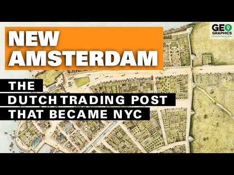
Manhattan was founded not by a nation (as was, say, Florida by Spain) or by refugees fleeing religious persecution (like the Pilgrims in Massachusetts and Quakers in Pennsylvania). Instead, the settlement began through a Dutch company with one overarching goal: profit. Henry Hudson—who’d sailed under his native British flag on previous journeys—wasn’t representing a country when, in 1609, he came upon what the native Lenape Indians called Manahatta, meaning “the place to get wood for bows.” He was traveling for the Dutch East India Company, searching for the elusive (and ultimately nonexistent) northwest passage between Europe and Asia. Instead, he found the aforementioned harbor and a plentiful yet tamable wilderness conducive not only to trapping animals for fur but also to cultivating farmland. In mere decades, New Amsterdam became a cornerstone of trade between its Caribbean sister colonies and, of course, The Netherlands itself. New Amsterdam was special for what it lacked. To promote a stable business environment, there was no official religion or stifling church influence. Worship privately, keep the money flowing publicly, and we’re all good. While interfaith (and interdenominational) flareups certainly occurred, the officially endorsed secularism fostered a diverse, multi-talented population where religious tolerance quickly became normalized. Unfortunately for the Dutch, this economy-over-ecclesiasticism mindset extended to national allegiance. When the British surrounded the city in 1664, residents of New Amsterdam hardly cared that their prosperous city was suddenly renamed for England’s Duke of York.[2]
8 Capital of the Continent (and Not the Country)
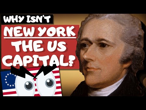
On April 30, 1789, George Washington was sworn in as the nation’s first president. The ceremony took place in New York City, which even by then had surpassed Philadelphia as the most natural choice for the fledgling country’s capital. The Supreme Court started in New York City, as did the U.S. Constitution’s Bill of Rights. The new president served the people from Federal Hall on Wall Street and resided in a modest house at 3 Cherry Street, which today overlooks both the Brooklyn and Manhattan Bridges. It didn’t last. Alexander Hamilton, the nation’s first Treasury Secretary, wanted the new federal government to cover state debts incurred during the Revolutionary War. Given their lopsided role, the northern states had accrued far more onerous debt. Meanwhile, Secretary of State Thomas Jefferson, a Virginian, wanted something else entirely: a federal capital in a location more familiar and friendly to slaveholding states. In 1790, with the deal made, the government was temporarily moved to Philadelphia while a more permanent locale was constructed from scratch. In 1800, Washington’s successor, John Adams, became the first president to govern from the newly minted White House in a city already named for the recently deceased (1799) Washington. In hindsight, NYC was better off NOT being the U.S. capital. The ever-expanding federal government would have consumed far too much of Manhattan’s limited real estate and likely prevented it from reaching its full potential as the hemisphere’s financial, cultural, and media engine.[3]
7 Water Works, Part I: The Erie Canal
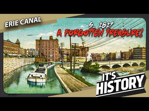
Legend has it New York’s nickname, “The Empire State,” stems from George Washington citing it as the hub of Britain’s New World holdings. However, it took arguably the most ambitious engineering feat in American history to turn that moniker into reality. Watch this video on YouTube Explorers had long searched for a water route to the west because the dearth of efficient transportation kept populations—and trade—confined to coastal areas. In the early 1800s, the modern-day Midwest was rich in timber, minerals, and fertile land… but it took weeks to reach via rutted roads prone to impassable mud and snow. In 1807, a flour merchant named Jesse Hawley—who’d gone bankrupt trying to transport his goods to NYC from upstate—proposed (from debtor’s prison, no less!) the seemingly impossible: a 400-mile (644-kilometer) canal from Lake Erie to Albany, for convergence with the Hudson River. It took a full decade and a popular commission chairman, DeWitt Clinton, to get the project approved and commenced. Scheduled for eight years, the effort would create a channel 363 miles (584 kilometers) long, 40 feet (12 meters) wide, and 4 feet (1.2 meters) deep. Clinton was soon elected governor and would become the namesake of streets across NYC—and towns across the Midwest. Completed in 1825, the Erie Canal spurred the first great westward movement of American settlers, gave the country’s overwhelmingly coastal population access to resources west of the Appalachian mountains, and made New York City the commercial capital of the United States.[4]
6 Water Works, Part II: The Croton Aqueduct
By 1800, another challenge threatening NYC’s growth was a lack of clean drinking water. Since its founding, the city’s residents procured fresh water from wells, ponds, and springs. The first major source was Kolch-Hook, Dutch for “small body of water.” Ironically, the English corrupted the word to “Collect,” and during its first century under British rule, the Collect Pond collected human and animal waste and runoff from tanneries. Watch this video on YouTube In 1799, New York’s State Legislature tasked the newly formed Manhattan Company—headed by future Vice President and Alexander Hamilton duel-mate Aaron Burr—with supplying more hospitable H2O. Burr’s answer was an ill-conceived well designed to funnel the Collect Pond’s fetid water to a purification station. Notably, NYC’s first high-profile homicide victim was found in this well shortly after its opening. (The well still exists under a clothing store on Spring Street.) The water crisis dragged on. In 1832, a cholera outbreak killed 3,500 New Yorkers. Something had to change. City officials ultimately decided to take water from the Croton River, north of the Bronx, in modern-day Westchester County. In 1837, nearly 4,000 men began to work on what became the Old Croton Aqueduct. The engineering feat included the Old Croton Dam, which created a lake 5 miles (8 kilometers) long that covered about 400 acres (162 hectares) and contained 660 million gallons (2.5 billion liters) of water. In all, the aqueduct carried water 41 miles (66 kilometers), completely by gravity, to a reservoir at the modern-day site of Central Park’s famous Great Lawn.[5]
5 Order! Order! The Grid
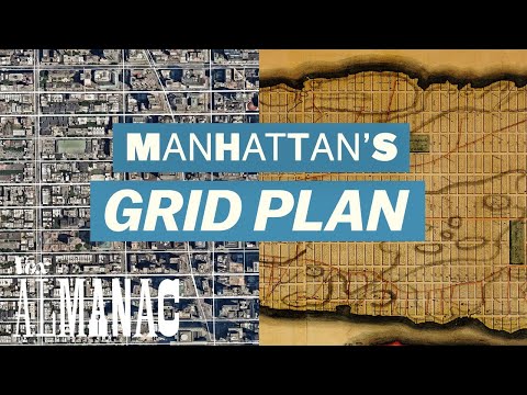
By the turn of the 19th century, it was clear that New York City was well on its way to becoming the country’s largest, most influential metropolis. Though it doesn’t sound like much today, the city’s 60,000 residents in 1800 would grow 20% to 72,000 by 1810, with no ceiling in sight. Watch this video on YouTube What was in sight was… well, chaos. Concentrated on Manhattan’s southern tip since the early 1600s, the city was a confusing hodgepodge of curving alleys, diagonal lanes, and aimless pathways. Several late-18th-century fires—including one sparked during Britain’s yearslong occupation during the American Revolution—added burned-out blight to the mess. By 1811, city authorities mixed foresight with fed-upness. Meeting the city’s directionless disarray with what many deemed rigid overcompensation, a council called the Commissioners’ Plan established the modern grid of 12 north-south avenues and 155 east-west streets. Comprising 2,028 blocks in total, what has been called “the single most important document in New York City’s development” applied to the entirely of Manhattan north of 14th Street, which at the time was the northern edge of NYC’s urbanity. The grid had just one significant exception: Broadway, which had cut a path across the island well before Europeans showed up. As its neat, often uniform lots filled in throughout the mid-1800s, the grid made real estate plots comparable and predictable and—a practical perk—made it nearly impossible to get lost for more than a block or two.[6]
4 The Five Points & Civics Reform
New York City pioneered sweeping positive changes to urban life. And it did so because… well, because it had a neighborhood so terrible that it absolutely mandated sweeping changes. If necessity is the mother of invention, Lower Manhattan’s notorious Five Points neighborhood is the abusive parent of modern-day civics reform. Watch this video on YouTube Right from the get-go, the Five Points—named for a star-shaped intersection of thoroughfares in modern-day Chinatown—was a hellhole. Constructed on a mucky, uneven landfill following the unceremonious 1811 draining of the fetid Collect Pond, the area was essentially designated for the destitute to occupy makeshift buildings under which the ground literally shifted. Poor Irish immigrants fought first with poor native-born Americans, then with the legions of Germans and other ethnicities competing for work and elbow room. As the population grew, living conditions plummeted. By the mid-1800s, the Five Points featured levels of disease, child mortality, unemployment, prostitution, violent crime, and general awfulness that had no Western World comparison, save for pockets of London’s East End. Eventually, calls came to clean up the Five Points. And more than anything, Jacob Riis’s1890 photo collection, “How the Other Half Lives,” pushed a fledgling movement into action. The collection prompted the first meaningful legislation aimed at improving conditions in tenement housing, as well as a more organized, thorough approach to sanitation. While the Five Points ultimately couldn’t be salvaged—most of it was simply razed—Riis’s eye-opening photos led to improved conditions in low-income areas throughout NYC.[7]
3 Brooklyn or Bust: The Birth of Greater New York City
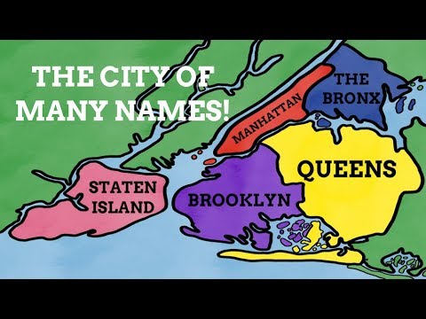
By the late 1800s, Manhattan’s then-aspirational 1811 grid plan had filled in and then some. One eye-popping statistic: In 1880, NYC’s population was 1.9 million. Ten years later, it had ballooned to 2.7—a 42% increase in a DECADE. And then, in 1898, it ate the fourth-largest city in the country. Just across the East River from Manhattan’s ever-escalating skyline lay Brooklyn, which by 1890 had 838,000 residents—behind only Philadelphia, Chicago, and its bridge-connected brother. But by then, the Greater New York City movement had swallowed up the Bronx to the north and was looking to add Brooklyn along with Queens and Staten Island. The argument for consolidation was a streamlining of municipal services, standardization of schooling and taxation, and other questionable perks. However, voters in all affected areas had to consent. Queens and Staten Island voters overwhelmingly assented. Brooklyn, though, saw vehement protests marked by public demonstrations and even a theme song, “Up with the Flag of Brooklyn!”. Then, 130,000 votes were cast. The referendum passed by under 300. With Brooklyn officially in the fold, the newly amalgamated New York City was less than three decades shy of surpassing London as the world’s most populous. NYC, then, is really two merged metropolises. Had consolidation never occurred, Brooklyn still would have been America’s fourth-largest city as recently as the 2010s. Today, its 2.7 million residents make it the most populous of NYC’s five boroughs.[8]
2 Track Star: The NYC Subway System
NYC’s first commuter trains opened in 1863. On the plus side, the elevated trains brought NYC’s northward-expanding residents far more efficiently to their mostly Lower Manhattan workplaces. They then could avoid the chaos and horse manure of the thoroughfares below. On the minus side, the trains blocked sunlight and often rained sparks down upon pedestrians. The underground subway dates to 1904, trailing Boston’s by a few years. Beginning at Centre Street, the line ran north along Lafayette Street, up Fourth Avenue to Grand Central Station, then tacked west to cover Times Square before heading up Broadway to West 145th Street. Elements of this route survive in the No. 6 Train, the Grand Central-Times Square Shuttle (or S Train), and the No. 1 Train. Since then, both the subway and the city have grown exponentially. Today, the NYC subway comprises 472 stations along 245 miles (394 kilometers) of routes. That’s nearly double America’s runner-up, Washington, D.C., at 129 miles (207 kilometers). Only 11 other cities have longer routes—and none have more stations. Two things make NYC’s subway system special. First, it doesn’t do “zones,” meaning the fare is the same ($2.75 per trip), whether going eight blocks or eight miles. Second, it operates 24/7—a must-have in a city that never sleeps. In fact, the system has only been interrupted 13 times due to extenuating circumstances ranging from COVID-19 disinfection to hurricane flooding to the September 11, 2001, terrorist attacks.[9]
1 Manhattan Melting Pot
In 1907, an astounding 1.25 million newcomers passed through New York’s Ellis Island immigration center. It was Ellis Island’s most prolific year and was smack in the middle of an immigration wave spanning the 1880s through the mid-1920s. Unsurprisingly, a sizable portion of foreigners entering the United States through New York City stayed put. First and foremost, NYC had employment opportunities—especially for unskilled manual laborers—far more plentiful than in other locales. Second, getting to NYC from their port of entry was a few blocks rather than a few hundred miles. From there, word spread to the diverse populations coming to America’s shores that pockets of their own people—and their own language and customs—could be found in NYC. By the turn of the 20th century, this snowball effect resulted in exceptionally concentrated ethnic neighborhoods. Even ten years prior, in 1890, Manhattan’s Lower East Side had the highest population density in the world—some 335,000 residents per square mile, largely Jewish and Italian immigrants. This natural pattern of starting in the New World with old countrymen built NYC’s famous ethnic neighborhoods, including not only the Jewish Lower East Side and Little Italy but also Chinatown and Harlem’s African-American renaissance. Outer borough enclaves include the Polish in Greenpoint, Brooklyn; Indians in Richmond Hill, Queens; and, of course, second and third Chinatowns in Brooklyn and Queens, respectively.[10] Read More: Twitter Website

